Back Geumpa Gayo 2013 ACE زلزال آتشيه 2013 Arabic Terremoto de Aceh de 2013 Spanish زمینلرزه ۲۰۱۳ آچه اندونزی Persian Acehin maanjäristys 2013 Finnish Gempa bumi Aceh 2013 ID Sismo de Achém de 2013 Portuguese Cutremurul din Aceh (2013) Romanian 2013年亞齊地震 Chinese
| UTC time | 2013-07-02 07:37:02 |
|---|---|
| ISC event | 603173687 |
| USGS-ANSS | ComCat |
| Local date | 2 July 2013 |
| Local time | 2:37pm (UTC+7) |
| Duration | 15 seconds |
| Magnitude | 6.1 Mw |
| Depth | 10 km (6 mi) |
| Epicenter | 4°41′53″N 96°41′13″E / 4.698°N 96.687°E |
| Type | Strike-slip[1] |
| Areas affected | Indonesia |
| Total damage | 4,292 houses damaged[2] |
| Max. intensity | MMI VI (Strong)[3] |
| Landslides | Yes |
| Aftershocks | 4.3, 5.5, 5.2 Mw |
| Casualties | 43 dead, 6 missing,[4] 2,532 injured[5] |
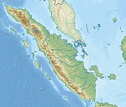
On 2 July 2013, an earthquake struck the Indonesian island of Sumatra on 2 July with a moment magnitude of 6.1 and a maximum Mercalli intensity of VI (Strong). The strike-slip earthquake killed at least 43 people[4] and injured more than 2,500 others[5] in the province of Aceh (on the northern end of Sumatra) where approximately 4,300 homes were damaged or destroyed.
- ^ Cite error: The named reference
USGSwas invoked but never defined (see the help page). - ^ "Death toll in Indonesia quake rises to 35; rescuers search for missing", CNN, 6 July 2013
- ^ RILIS PERS DAMPAK DAN PENANGANAN BENCANA GEMPA BUMI 6,2 SR DI BENER MERIAH DAN ACEH TENGAH, Badan Nasional Penanggulangan Bencana, July 3, 2013
- ^ a b BNBP (September 2013). "Gema BNBP" (PDF) (in Indonesian). pp. 40–41.
- ^ a b OCHA (19 July 2013). "Indonesia: Aceh Tengah Earthquake Situation Report – 19 July 2013" (PDF). Retrieved 2 July 2022.
